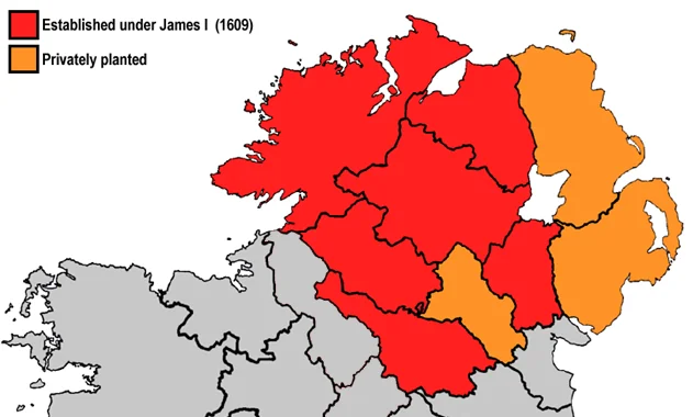
The Plantation of Ulster (1610) — settlement distribution map
Image
Plantation of Ulster
Creator
Modern reconstruction (Wikimedia Commons)
Current location
Wikimedia Commons
Provenance
Public domain reconstruction.
Content note
Settlement distribution during the Plantation of Ulster (1610), when six counties — Donegal, Londonderry, Tyrone, Fermanagh, Cavan and Armagh — were confiscated from the Gaelic Irish chiefs and parceled out to Scottish Lowland and English Protestant undertakers. Brant Hindman's Ewing ancestor Sir William Ewing II Baron (b. 1625 Stirlingshire Scotland) settled at Coleraine, Co. Londonderry, in 1684 as part of this colonial process. His Hindman ancestor Reverend John Hindman (b. 1720 Co. Londonderry) was a third-generation Plantation Scots-Irish Presbyterian minister.